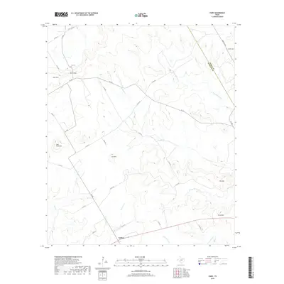
2019 Map of Fairy
USGS Topo · Published 2019About this map
Lanham sits at the southern edge of this Central Texas landscape, where the headwaters of several significant drainages emerge from the high ground of the Hamilton Co and Bosque Co line. The terrain is defined by a series of prominent rises including Twin Mountains, Lone Mtn, and Stroud Mtn, which separate the various branches of the river systems. Northward-flowing waters like N Prong Meridian Cr and S Prong Meridian Cr eventually join Meridian Cr, while the southern reaches contribute to N Fork Neils Cr.
Find a feature on this map
37 named features on this map. Tap any name to fly to it.
Don’t see what you’re looking for? This feature index may not catch every label — zoom into the map to look around manually.
Map Details
Editions of this 2019 Fairy Map
This is the sole edition of this map. No revisions or reprints were ever made.
Other maps of this area

1888 · Hamilton
USGS Topo · 1:125,000

1888 · Meridian
USGS Topo · 1:125,000

1894 · Hamilton
USGS Topo · 1:125,000

1894 · Meridian
USGS Topo · 1:125,000

1954 · Brownwood
USGS Topo · 1:250,000

1954 · Waco
USGS Topo · 1:250,000

1955 · Waco
USGS Topo · 1:250,000

1956 · Cranfills Gap
USGS Topo · 1:24,000
1956 · German Valley
USGS Topo · 1:24,000

1956 · Hico
USGS Topo · 1:62,500