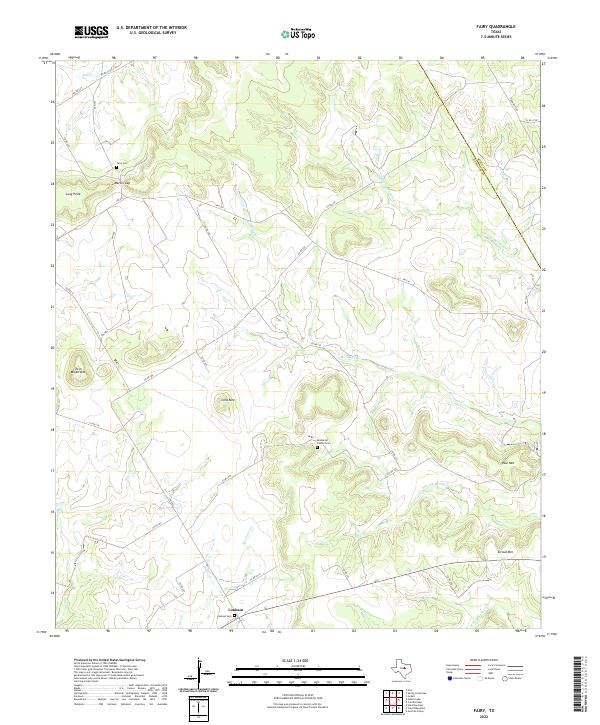
2022 Map of Fairy
USGS Topo · Published 2022About this map
Meridian Creek and its complex network of tributaries, including North Prong Meridian Creek and South Prong Meridian Creek, define the topography of this rural Central Texas landscape. Near the settlement of Lanham, the terrain transitions into more pronounced relief with landmarks such as Stroud Mountain and Paul Mountain rising above the creek valleys. The map provides valuable detail for genealogists, identifying burial sites like the Brummett Family Cemetery and Lanham Cemetery.
Find a feature on this map
38 named features on this map. Tap any name to fly to it.
Don’t see what you’re looking for? This feature index may not catch every label — zoom into the map to look around manually.
Map Details
Editions of this 2022 Fairy Map
This is the sole edition of this map. No revisions or reprints were ever made.
Other maps of this area

1888 · Hamilton
USGS Topo · 1:125,000

1888 · Meridian
USGS Topo · 1:125,000

1894 · Hamilton
USGS Topo · 1:125,000

1894 · Meridian
USGS Topo · 1:125,000

1954 · Brownwood
USGS Topo · 1:250,000

1954 · Waco
USGS Topo · 1:250,000

1955 · Waco
USGS Topo · 1:250,000

1956 · Cranfills Gap
USGS Topo · 1:24,000
1956 · German Valley
USGS Topo · 1:24,000

1956 · Hico
USGS Topo · 1:62,500