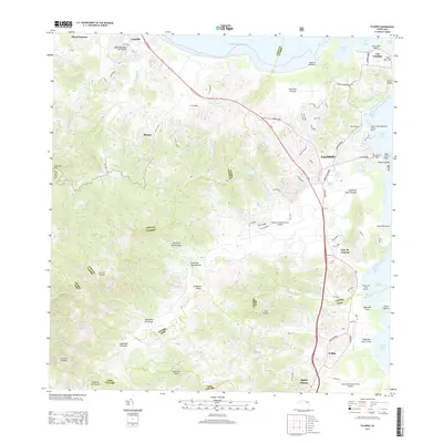
2013 Map of Fajardo
USGS Topo · Published 2013About this map
Fajardo serves as the focal point for this coastal survey of northeast Puerto Rico, showing the town and its maritime infrastructure in the early 21st century. The coastline is defined by significant nautical hubs, including Puerto del Rey Marina to the south and Puerto Chico Marina further north. These facilities, along with the Diego Jimenez Torres Airport and the larger Jose Aponte de la Torre Airport near Ceiba, illustrate the region's importance as a transportation and tourism gateway.
Find a feature on this map
58 named features on this map. Tap any name to fly to it.
Don’t see what you’re looking for? This feature index may not catch every label — zoom into the map to look around manually.
Map Details
Editions of this 2013 Fajardo Map
This is the sole edition of this map. No revisions or reprints were ever made.
Other maps of this area

1941 · Rio Grande
USGS Topo · 1:30,000

1945 · Cayo Icacos
USGS Topo · 1:30,000

1945 · El Yunque
USGS Topo · 1:30,000

1946 · El Yunque
USGS Topo · 1:30,000

1946 · Humacao
USGS Topo · 1:30,000

1946 · Punta Puerca
USGS Topo · 1:30,000

1946 · Naguabo
USGS Topo · 1:30,000

1946 · Fajardo
USGS Topo · 1:30,000

1947 · El Yunque NE
USGS Topo · 1:10,000

1947 · Rio Grande
USGS Topo · 1:30,000