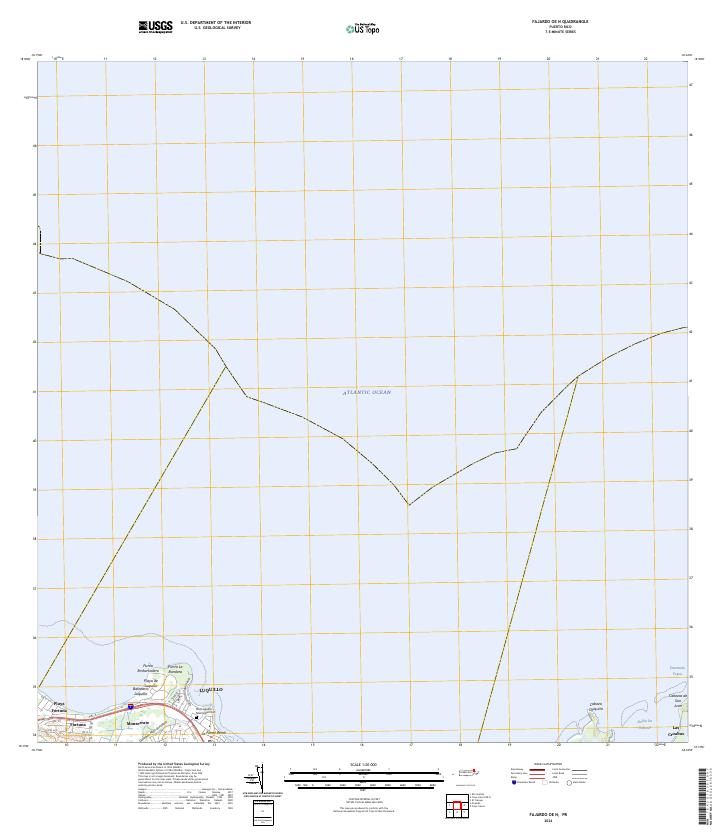
2024 Map of Fajardo OE N
USGS Topo · Published 2024About this map
Luquillo anchors this coastal survey, where the town's urban grid meets the Atlantic Ocean along a shoreline defined by prominent landmarks like Punta La Bandera and Punta Embarcadero. The map documents the interface of local infrastructure and the natural landscape, featuring the Old Luquillo Municipal Cem situated near the coast. Settlement patterns are concentrated along the PR-3 corridor, linking communities such as Playa Fortuna, Fortuna, and Monserrate.
Find a feature on this map
19 named features on this map. Tap any name to fly to it.
Don’t see what you’re looking for? This feature index may not catch every label — zoom into the map to look around manually.
Map Details
Editions of this 2024 Fajardo OE N Map
This is the sole edition of this map. No revisions or reprints were ever made.
Other maps of this area

1941 · Rio Grande
USGS Topo · 1:30,000

1945 · Cayo Icacos
USGS Topo · 1:30,000

1945 · El Yunque
USGS Topo · 1:30,000

1946 · El Yunque
USGS Topo · 1:30,000

1946 · Fajardo
USGS Topo · 1:30,000

1947 · El Yunque NE
USGS Topo · 1:10,000

1947 · Rio Grande
USGS Topo · 1:30,000
1947 · Fajardo NO
USGS Topo · 1:10,000

1947 · Fajardo NE
USGS Topo · 1:10,000
1950 · Rio Grande SE
USGS Topo · 1:10,000