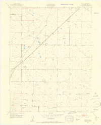
1948 Map of Falcon
USGS Topo · Published 1952About this map
The settlement at Falcon serves as the focal point of this 1948 topographic study, situated at the junction of the Chicago Rock Island and Pacific and the Colorado and Southern railroads. This intersection in El Paso County highlights a transition from early rail-dependent commerce to the growing network of regional roads like the Falcon Highway and Burgess Road. The landscape is predominantly characterized by scattered family ranches, such as Old Brown Ranch, Bennett Ranch, and Gieck Ranch, illustrating a decentralized agricultural economy spread across the plains east of the Rockies.
Find a feature on this map
29 named features on this map. Tap any name to fly to it.
Don’t see what you’re looking for? This feature index may not catch every label — zoom into the map to look around manually.
Map Details
Editions of this 1948 Falcon Map
2 editions found
Other maps of this area

1893 · Big Springs
USGS Topo · 1:125,000

1893 · Colorado Springs
USGS Topo · 1:125,000

1894 · Castle Rock
USGS Topo · 1:125,000

1909 · Colorado Springs
USGS Topo · 1:125,000

1913 · Castle Rock
USGS Topo · 1:125,000

1940 · Elbert
USGS Topo · 1:62,500

1942 · Colorado Springs
USGS Topo · 1:125,000

1944 · Elbert
USGS Topo · 1:62,500

1948 · Falcon
USGS Topo · 1:24,000

1948 · Falcon
USGS Topo · 1:62,500