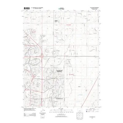
2013 Map of Falcon NW
USGS Topo · Published 2013About this map
Colorado Springs expands toward its northeastern fringes in this detailed survey, showing a landscape defined by rapid suburban development meeting ranching history. The grid of the city gives way to emerging communities like Cimarron Hills and Wolf Ranch, while established agricultural holdings like the Banning Lewis Ranch and Hyatt Ranch still occupy significant acreage. The terrain is marked by the eponymous Black Forest to the north, a distinctive timbered upland that stands in contrast to the open plains. Drainage patterns are well-defined by the paths of Sand Creek, Cottonwood Cr, and Jimmy Camp Creek, which carve through the high-desert environment. Local transportation and residential growth are visible in the winding networks of Briargate Pkwy and Dublin Blvd, highlighting the mid-2010s transformation of these former rangelands into a modern metropolitan corridor.
Find a feature on this map
82 named features on this map. Tap any name to fly to it.
Don’t see what you’re looking for? This feature index may not catch every label — zoom into the map to look around manually.
Map Details
Editions of this 2013 Falcon NW Map
This is the sole edition of this map. No revisions or reprints were ever made.
Other maps of this area

1893 · Colorado Springs
USGS Topo · 1:125,000

1894 · Castle Rock
USGS Topo · 1:125,000

1909 · Colorado Springs
USGS Topo · 1:125,000

1913 · Castle Rock
USGS Topo · 1:125,000

1940 · Elbert
USGS Topo · 1:62,500

1942 · Colorado Springs
USGS Topo · 1:125,000

1944 · Elbert
USGS Topo · 1:62,500

1948 · Falcon
USGS Topo · 1:24,000

1948 · Colorado Springs
USGS Topo · 1:62,500

1948 · Pikeview
USGS Topo · 1:24,000