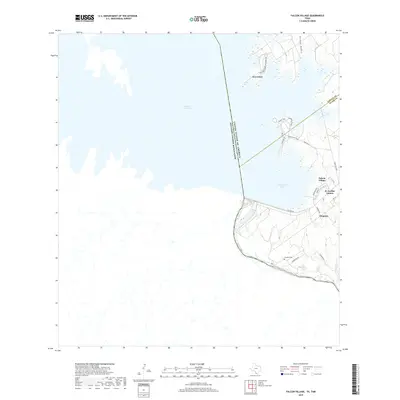
2019 Map of Falcon Village
USGS Topo · Published 2019About this map
Falcon Reservoir and the Rio Grande define the international boundary landscape where Zapata and Starr counties meet the border of Mexico. This map details the recreational and residential developments along the water's edge, including the planned streets of Falcon Village and the nearby H. Cuellar Estates. The terrain is characterized by complex inlets like Government Cove and the drainage of Arroyo Medio. Near the settlement of Chapeno, the presence of the Chapeno Cem provides a focal point for genealogical research in this riverfront community. Traces of local travel are evident in the network of trails such as Roadrunner Trail and Desert Trail, which snake through the arid landscape north of the reservoir's main body.
Find a feature on this map
29 named features on this map. Tap any name to fly to it.
Don’t see what you’re looking for? This feature index may not catch every label — zoom into the map to look around manually.
Map Details
Editions of this 2019 Falcon Village Map
This is the sole edition of this map. No revisions or reprints were ever made.
Other maps of this area

1938 · Falcon
USGS Topo · 1:62,500

1949 · Mc Allen
USGS Topo · 1:250,000

1954 · McAllen
USGS Topo · 1:250,000

1956 · Roma
USGS Topo · 1:62,500

1957 · Mc Allen
USGS Topo · 1:250,000

1962 · McAllen
USGS Topo · 1:250,000

1965 · Salineno
USGS Topo · 1:24,000
1965 · Falcon Village
USGS Topo · 1:24,000

1965 · Lopeno
USGS Topo · 1:24,000
1965 · Beckwith Arm
USGS Topo · 1:24,000