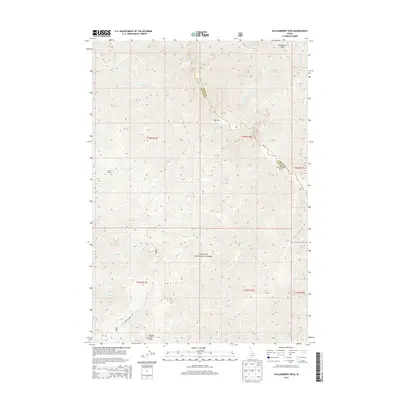
2013 Map of Falconberry Peak
USGS Topo · Published 2013About this map
Falconberry Peak and the high ridges of the Challis National Forest dominate this landscape in Custer County. The terrain is defined by a dense network of drainages including Loon Creek, Indian Creek, and Cold Spring Creek, which carve through the elevations between Grouse Creek Peak and the surrounding summits. Human presence in this high-altitude environment is centered on isolated points of activity like Falconberry Ranch and Biggs Ranch, which sit along the winding watercourses. Evidence of forest management and fire observation is found at Cougar Lookout, while the southern reaches are accessible via the unpaved Grouse Creek Rd. This map documents a quiet, sparsely populated corner of Idaho where life is dictated by the steep topography and the boundaries between Custer and Lemhi counties.
Find a feature on this map
30 named features on this map. Tap any name to fly to it.
Don’t see what you’re looking for? This feature index may not catch every label — zoom into the map to look around manually.
Map Details
Editions of this 2013 Falconberry Peak Map
This is the sole edition of this map. No revisions or reprints were ever made.
Other maps of this area

1930 · Casto
USGS Topo · 1:125,000

1957 · Challis
USGS Topo · 1:250,000

1960 · Challis
USGS Topo · 1:250,000

1962 · Norton Ridge
USGS Topo · 1:24,000

1962 · Ramey Hill
USGS Topo · 1:24,000

1963 · Challis
USGS Topo · 1:250,000

1963 · Pinyon Peak
USGS Topo · 1:24,000

1963 · Casto
USGS Topo · 1:24,000

1963 · Rock Creek
USGS Topo · 1:24,000
1963 · Sherman Peak
USGS Topo · 1:24,000