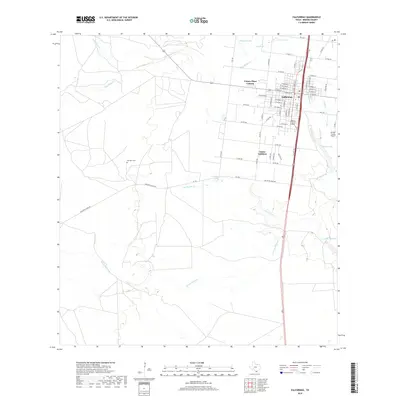
2019 Map of Falfurrias
USGS Topo · Published 2019About this map
Falfurrias serves as the focal point of this South Texas landscape, where a grid of residential streets like W Rice St and W Adams St meets the open rangeland of Brooks County. The settlement pattern is defined by traditional neighborhoods and newer developments such as the Victory Place Colonia and Cantu Addition. Outside the city center, the terrain is characterized by a network of intermittent waterways, including Palo Blanco Cr and Cibolo Cr, which drain toward the coast.
Find a feature on this map
68 named features on this map. Tap any name to fly to it.
Don’t see what you’re looking for? This feature index may not catch every label — zoom into the map to look around manually.
Map Details
Editions of this 2019 Falfurrias Map
This is the sole edition of this map. No revisions or reprints were ever made.
Other maps of this area

1921 · Falfurrias
USGS Topo · 1:125,000

1956 · Laredo
USGS Topo · 1:250,000

1963 · Flowella
USGS Topo · 1:24,000

1963 · Falfurrias SE
USGS Topo · 1:24,000

1963 · Premont West
USGS Topo · 1:24,000

1963 · Cage Ranch
USGS Topo · 1:24,000
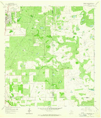
1963 · Premont East
USGS Topo · 1:24,000

1963 · Falfurrias
USGS Topo · 1:24,000

1968 · Palomas Ranch SE
USGS Topo · 1:24,000

1968 · Palomas Ranch
USGS Topo · 1:24,000