
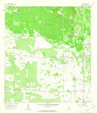
1963 Map of Cage Ranch
USGS Topo · Published 1964About this map
The industrial and ranching landscapes of South Texas intersect here in the early 1960s, defined by the expansive Cage Gas Field and the Tres Encinos Oil Field. This area of Brooks County is characterized by large private holdings such as the namesake Cage Ranch and the Wagenstein Ranch, where the extraction economy sits alongside traditional cattle country. A network of pipelines and service roads crisscrosses the terrain, supporting the energy infrastructure while the Southern Pacific railroad runs north-to-south along the eastern edge, passing through the small settlement at Dixie.
Find a feature on this map
17 named features on this map. Tap any name to fly to it.
Don’t see what you’re looking for? This feature index may not catch every label — zoom into the map to look around manually.
Map Details
Editions of this 1963 Cage Ranch Map
This is the sole edition of this map. No revisions or reprints were ever made.
Other maps of this area

1921 · Falfurrias
USGS Topo · 1:125,000

1939 · Encantada
USGS Topo · 1:62,500

1949 · Mc Allen
USGS Topo · 1:250,000

1954 · McAllen
USGS Topo · 1:250,000

1956 · Laredo
USGS Topo · 1:250,000

1957 · Mc Allen
USGS Topo · 1:250,000

1962 · McAllen
USGS Topo · 1:250,000

1963 · Flowella
USGS Topo · 1:24,000

1963 · Falfurrias SE
USGS Topo · 1:24,000
1963 · Encino
USGS Topo · 1:24,000