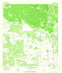
1963 Map of Encino
USGS Topo · Published 1965About this map
Deep South Texas ranching and industrial activity characterize this landscape during the early 1960s. The Southern Pacific railroad serves as the primary corridor for the region, linking the small community of Encino and the Rachal Siding at Rachal to broader markets. The terrain is marked by distinct pastures such as Los Muertos Pasture and Bermuda Pasture, reflecting the area's agricultural heritage.
Find a feature on this map
25 named features on this map. Tap any name to fly to it.
Don’t see what you’re looking for? This feature index may not catch every label — zoom into the map to look around manually.
Map Details
Editions of this 1963 Encino Map
2 editions found
Other maps of this area

1921 · Falfurrias
USGS Topo · 1:125,000

1939 · Encantada
USGS Topo · 1:62,500

1949 · Mc Allen
USGS Topo · 1:250,000

1954 · McAllen
USGS Topo · 1:250,000

1956 · Laredo
USGS Topo · 1:250,000

1957 · Mc Allen
USGS Topo · 1:250,000

1962 · McAllen
USGS Topo · 1:250,000

1963 · Falfurrias SE
USGS Topo · 1:24,000

1963 · Cage Ranch
USGS Topo · 1:24,000
1963 · Callo Padrones
USGS Topo · 1:24,000