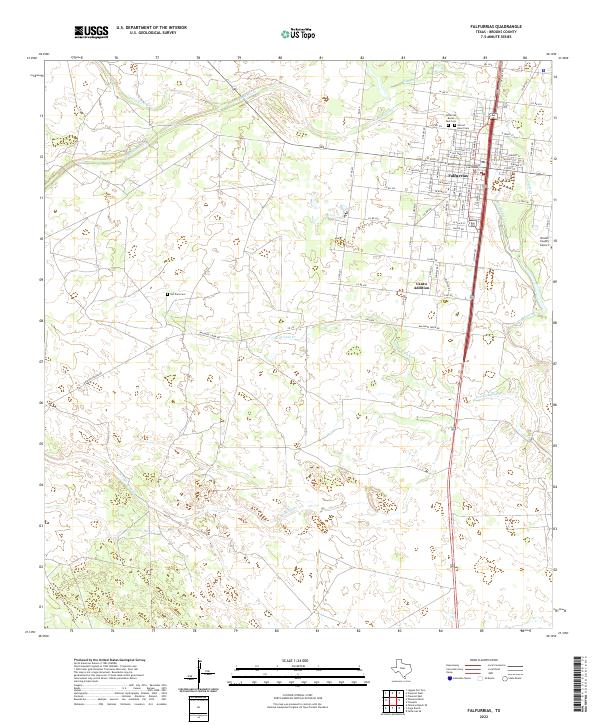
2022 Map of Falfurrias
USGS Topo · Published 2022About this map
Falfurrias serves as the focal point of this South Texas landscape, where the town's grid meets the branching waterways of the coastal plain. The civic heart of the area is anchored by the Brooks County Courthouse, while the outskirts are marked by several significant burial sites, including the Falfurrias Burial Park Cem and the Old Town Cem. The terrain is defined by a series of intermittent creeks that carve through the brush country, most notably Palo Blanco Cr, Cibolo Cr, and the long reach of Arroyo Baluarte to the south.
Find a feature on this map
68 named features on this map. Tap any name to fly to it.
Don’t see what you’re looking for? This feature index may not catch every label — zoom into the map to look around manually.
Map Details
Editions of this 2022 Falfurrias Map
This is the sole edition of this map. No revisions or reprints were ever made.
Other maps of this area

1921 · Falfurrias
USGS Topo · 1:125,000

1956 · Laredo
USGS Topo · 1:250,000

1963 · Flowella
USGS Topo · 1:24,000

1963 · Falfurrias SE
USGS Topo · 1:24,000

1963 · Premont West
USGS Topo · 1:24,000

1963 · Cage Ranch
USGS Topo · 1:24,000
1963 · Premont East
USGS Topo · 1:24,000

1963 · Falfurrias
USGS Topo · 1:24,000

1968 · Palomas Ranch SE
USGS Topo · 1:24,000

1968 · Palomas Ranch
USGS Topo · 1:24,000