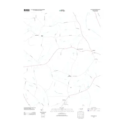
2013 Map of Falkland
USGS Topo · Published 2013About this map
The Tar River defines the eastern edge of this agricultural landscape in Pitt County, where generations of family farming have shaped the local geography. Distinctive rural communities such as Falkland, Cobb Town, and Sharp Point are connected by a network of roads that frequently bear the names of local families, including Stallings Rd and Buck Moore Rd. The map reveals a land heavily influenced by its hydrology, with numerous small waterways like Kitten Cr, Tyson Cr, and Oldwoman Branch carving through the terrain.
Find a feature on this map
54 named features on this map. Tap any name to fly to it.
Don’t see what you’re looking for? This feature index may not catch every label — zoom into the map to look around manually.
Map Details
Editions of this 2013 Falkland Map
This is the sole edition of this map. No revisions or reprints were ever made.
Other maps of this area

1901 · Parmele
USGS Topo · 1:62,500

1902 · Parmele
USGS Topo · 1:62,500

1902 · Tarboro
USGS Topo · 1:62,500

1903 · Tarboro
USGS Topo · 1:62,500

1903 · Winterville
USGS Topo · 1:62,500

1904 · Falkland
USGS Topo · 1:62,500

1905 · Winterville
USGS Topo · 1:62,500

1953 · Rocky Mount
USGS Topo · 1:250,000

1954 · Rocky Mount
USGS Topo · 1:250,000
1980 · Pinetops
USGS Topo · 1:24,000