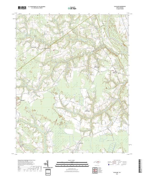
2022 Map of Falkland
USGS Topo · Published 2022About this map
Falkland and the surrounding coastal plain of Pitt County are defined by a network of slow-moving waterways and historic crossroads. The Tar River cuts through the northeast corner, while smaller drainage systems like Blue Swamp, Langs Mill Run, and Kittrell Cr lace the landscape, dictating the placement of early settlements and agricultural fields. This modern survey reflects the enduring rural character of the region, where family-named intersections such as Kings Crossroads and Dupree Crossroads serve as local anchors. In the southwest, the town of Fountain is a prominent hub, connected to the nearby Crestlawn Memorial Gardens. The county line between Edgecombe Co and Pitt Co bisects the northwest, passing near the small communities of Cobb Town and Sharp Point. Local infrastructure is marked by numerous farm lanes and roads named for local families, including Anderson Chapel Rd and Tyer Farm Ln.
Find a feature on this map
57 named features on this map. Tap any name to fly to it.
Don’t see what you’re looking for? This feature index may not catch every label — zoom into the map to look around manually.
Map Details
Editions of this 2022 Falkland Map
This is the sole edition of this map. No revisions or reprints were ever made.
Historical Maps of California Through Time
4 maps found