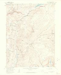
1958 Map of Fall River Pass
USGS Topo · Published 1962About this map
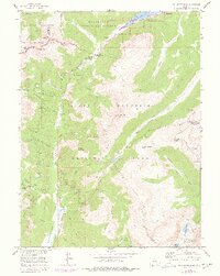
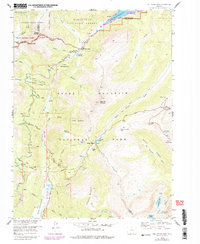
The Kawuneeche Valley serves as a central corridor for the headwaters of the Colorado River in this late 1950s survey. The landscape is defined by the high-altitude engineering of the Grand Ditch, which skirts the slopes of Mount Neota and Thunder Mountain to divert water across the Continental Divide. Cultural markers of the era include the Phantom Valley Ranch and the nearby Phantom Valley Trading Post, reflecting the mid-century transition of the area into a premier destination for mountain recreation. Evidence of earlier mining and logging history remains visible through the Lulu City (Site) and a Sawmill in Skeleton Gulch. The map meticulously tracks the winding paths of Tundra Curves and Medicine Bow Curve, highlighting the complex road engineering required to navigate the passes between the Roosevelt National Forest and Rocky Mountain National Park.
Find a feature on this map
82 named features on this map. Tap any name to fly to it.
Don’t see what you’re looking for? This feature index may not catch every label — zoom into the map to look around manually.
Map Details
Editions of this 1958 Fall River Pass Map
6 editions found
Other maps of this area

1915 · Longs Peak
USGS Topo · 1:125,000

1916 · Home
USGS Topo · 1:125,000

1919 · Rocky Mountain National Park
USGS Topo · 1:125,000

1920 · Home
USGS Topo · 1:125,000

1954 · Greeley
USGS Topo · 1:250,000

1957 · Greeley
USGS Topo · 1:250,000

1957 · Mc Henrys Peak
USGS Topo · 1:24,000

1957 · Trail Ridge
USGS Topo · 1:24,000

1957 · Mount Richthofen
USGS Topo · 1:24,000

1957 · Bowen Mountain
USGS Topo · 1:24,000