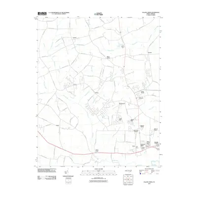
2010 Map of Falling Creek
USGS Topo · Published 2010About this map
Falling Creek winds southward through this part of Lenoir County, anchoring a landscape where agricultural crossroads meet the expanding residential outskirts of Kinston. The map highlights several established communities such as Institute and Dawson, alongside numerous modern residential developments including Kinstonian Hights, Castle Oaks, and Random Woods. This era reflects a period of transition, where family-named landmarks like Hardison Crossroads and legacy rural features like the Grays Millpond Dam persist amidst a growing suburban footprint.
Find a feature on this map
89 named features on this map. Tap any name to fly to it.
Don’t see what you’re looking for? This feature index may not catch every label — zoom into the map to look around manually.
Map Details
Editions of this 2010 Falling Creek Map
This is the sole edition of this map. No revisions or reprints were ever made.
Other maps of this area

1914 · Kinston
USGS Topo · 1:48,000

1916 · Kinston
USGS Topo · 1:62,500

1953 · Rocky Mount
USGS Topo · 1:250,000

1954 · Rocky Mount
USGS Topo · 1:250,000

1957 · Goldsboro
USGS Topo · 1:62,500

1957 · Seven Springs
USGS Topo · 1:62,500

1958 · Deep Run
USGS Topo · 1:62,500

1980 · Seven Springs
USGS Topo · 1:24,000
1980 · Deep Run
USGS Topo · 1:24,000
1980 · Rivermont
USGS Topo · 1:24,000