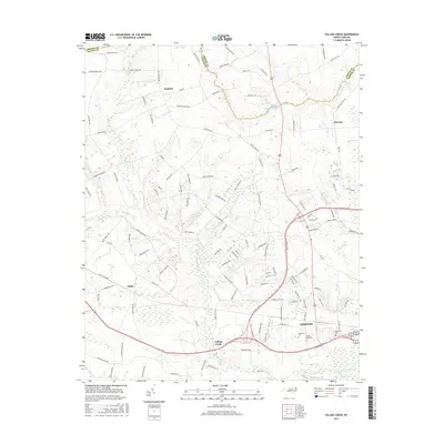
2016 Map of Falling Creek
USGS Topo · Published 2016About this map
Kinston anchors the southeastern corner of this survey, where the Neuse River bends through the coastal plain of eastern North Carolina. The landscape is defined by an intricate network of waterways, including the broad Wheat Swamp and Gum Swamp Creek, which dictate the placement of rural settlements and agricultural plots. Moving north from the river, the small communities of Falling Creek, Fields, and Institute appear along a web of family-named roads like Harrison Phelps Road and Bryan Hardy Road.
Find a feature on this map
124 named features on this map. Tap any name to fly to it.
Don’t see what you’re looking for? This feature index may not catch every label — zoom into the map to look around manually.
Map Details
Editions of this 2016 Falling Creek Map
This is the sole edition of this map. No revisions or reprints were ever made.
Other maps of this area

1914 · Kinston
USGS Topo · 1:48,000

1916 · Kinston
USGS Topo · 1:62,500

1953 · Rocky Mount
USGS Topo · 1:250,000

1954 · Rocky Mount
USGS Topo · 1:250,000

1957 · Goldsboro
USGS Topo · 1:62,500

1957 · Seven Springs
USGS Topo · 1:62,500

1958 · Deep Run
USGS Topo · 1:62,500

1980 · Seven Springs
USGS Topo · 1:24,000
1980 · Deep Run
USGS Topo · 1:24,000
1980 · Rivermont
USGS Topo · 1:24,000