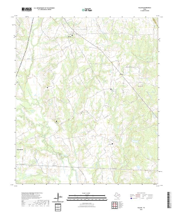
2022 Map of Fallon
USGS Topo · Published 2022About this map
The Navasota River and its tributary Pin Oak Cr define this area of Limestone County, where the rural landscape is marked by a deep-rooted pattern of small cemeteries and local settlements. Genealogists can find several family and community burial grounds, including the Webb Chapel Cem, Plummer Cem, and Shiloh Cem, which anchor the northern reaches near the hamlet of Shiloh. The map illustrates the transition from the traditional river-bottom geography to modern industrial footprints, evidenced by the presence of Mitchell Energy facilities south of the river. A dense network of local roads, such as LCR 430 and FM 39, connects these disparate sites, while landmarks like Morgan Hill rise above the surrounding creeks. Further south, the outskirts of Groesbeck begin to emerge, showing the early stages of urban expansion into the surrounding ranchland and creek valleys.
Find a feature on this map
82 named features on this map. Tap any name to fly to it.
Don’t see what you’re looking for? This feature index may not catch every label — zoom into the map to look around manually.
Map Details
Editions of this 2022 Fallon Map
This is the sole edition of this map. No revisions or reprints were ever made.
Other maps of this area

1920 · Mexia
USGS Topo · 1:62,500

1954 · Waco
USGS Topo · 1:250,000

1955 · Waco
USGS Topo · 1:250,000

1957 · Groesbeck
USGS Topo · 1:62,500

1960 · Groesbeck
USGS Topo · 1:24,000

1960 · Tehuacana
USGS Topo · 1:24,000

1963 · Teague North
USGS Topo · 1:24,000

1963 · Mexia
USGS Topo · 1:24,000

1966 · Thornton
USGS Topo · 1:24,000
1966 · Teague South
USGS Topo · 1:24,000