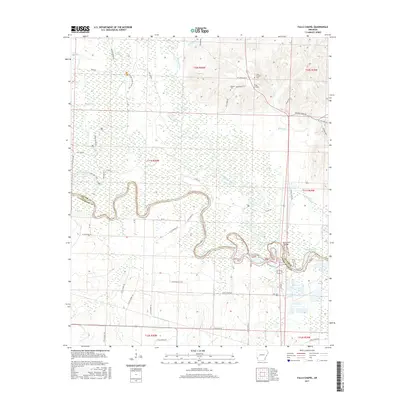
2017 Map of Falls Chapel
USGS Topo · Published 2017About this map
The Cossatot River meanders southward through this corner of Arkansas, defining the landscape before its confluence with the Little River and the expansive waters of Millwood Lake. The terrain is marked by a complex network of wetlands and backwaters, including Big Slough, Davis Slough, and Red Lake, reflecting the shifting hydrology of the river bottomlands. This area near the Sevier and Little River county line remains largely rural, characterized by scattered family landmarks and ecclesiastical sites that serve as anchors for the local community.
Find a feature on this map
58 named features on this map. Tap any name to fly to it.
Don’t see what you’re looking for? This feature index may not catch every label — zoom into the map to look around manually.
Map Details
Editions of this 2017 Falls Chapel Map
This is the sole edition of this map. No revisions or reprints were ever made.
Other maps of this area

1950 · Ashdown East
USGS Topo · 1:24,000

1950 · Ashdown West
USGS Topo · 1:24,000

1950 · Ben Lomond
USGS Topo · 1:24,000

1950 · Falls Chapel
USGS Topo · 1:24,000

1950 · Winthrop
USGS Topo · 1:24,000

1951 · Winthrop
USGS Topo · 1:24,000

1951 · Ben Lomond
USGS Topo · 1:24,000

1951 · Ashdown West
USGS Topo · 1:24,000

1951 · Falls Chapel
USGS Topo · 1:24,000

1951 · Ashdown East
USGS Topo · 1:24,000