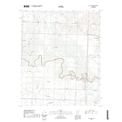
2020 Map of Falls Chapel
USGS Topo · Published 2020About this map
Ben Lomond and the winding reaches of the Little River anchor this topographic study of the borderlands between Sevier and Little River counties. The landscape is defined by the sharp transition from the elevated terrain of the Indian Hills in the northeast to the broad, marshy floodplains of the river bottomlands. Numerous sloughs and backwaters, such as Big Slough and Davis Slough, reflect the dynamic nature of the river system before it meets the Cossatot River. Local history and genealogy are centered around the community of Falls Chapel, which includes its namesake Falls Chapel Cem and nearby Hopson Cem. The road network is particularly intricate along the southern riverbanks, with numerous local routes like Little River 60 and Little River 100 providing access to the fertile but seasonally inundated lowlands.
Find a feature on this map
57 named features on this map. Tap any name to fly to it.
Don’t see what you’re looking for? This feature index may not catch every label — zoom into the map to look around manually.
Map Details
Editions of this 2020 Falls Chapel Map
This is the sole edition of this map. No revisions or reprints were ever made.
Other maps of this area

1950 · Ashdown East
USGS Topo · 1:24,000

1950 · Ashdown West
USGS Topo · 1:24,000

1950 · Ben Lomond
USGS Topo · 1:24,000

1950 · Falls Chapel
USGS Topo · 1:24,000

1950 · Winthrop
USGS Topo · 1:24,000

1951 · Winthrop
USGS Topo · 1:24,000

1951 · Ben Lomond
USGS Topo · 1:24,000

1951 · Ashdown West
USGS Topo · 1:24,000

1951 · Falls Chapel
USGS Topo · 1:24,000

1951 · Ashdown East
USGS Topo · 1:24,000