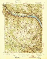
1945 Map of Falls Church
USGS Topo · Published 1945About this map
The Potomac River corridor between Maryland and Virginia serves as the anchor for this mid-century survey, revealing a landscape defined by historical river crossings and early suburban expansion. The Chesapeake and Ohio Canal runs parallel to the water, while various river-based landmarks like Offutt Ferry, Hermit Ferry, and the Cabin John Bridge illustrate the critical transit points of the era. On the Virginia side, the Washington and Old Dominion Railroad cuts through the region, connecting burgeoning communities such as Dunn Loring, West Falls Church, and East Falls Church.
Find a feature on this map
137 named features on this map. Tap any name to fly to it.
Don’t see what you’re looking for? This feature index may not catch every label — zoom into the map to look around manually.
Map Details
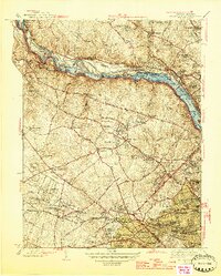
Editions of this 1945 Falls Church Map
2 editions found
Other maps of this area

1890 · Mt. Vernon
USGS Topo · 1:125,000

1891 · Mt. Vernon
USGS Topo · 1:125,000

1893 · Frederick
USGS Topo · 1:125,000

1894 · Frederick
USGS Topo · 1:125,000

1894 · Mt. Vernon
USGS Topo · 1:125,000

1897 · Mt. Vernon
USGS Topo · 1:125,000

1900 · Washington
USGS Topo · 1:62,500

1908 · Rockville
USGS Topo · 1:62,500

1908 · Seneca
USGS Topo · 1:62,500

1915 · Fairfax
USGS Topo · 1:62,500