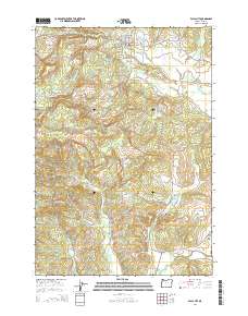
2014 Map of Falls City
USGS Topo · Published 2014About this map
Falls City stands at the eastern edge of the coastal range where the Little Luckiamute River flows out toward the Willamette Valley. This area shows a landscape defined by its timber and water resources, evidenced by the numerous reservoirs such as Steen Reservoir, Frink Reservoir, and the Falls City Reservoir. The map details the transition from the relatively level valley floor near Bridgeport and Pedee into the steeper terrain of the west, marked by Mt Sykes and the drainage network of Teal Cr and N Fork Pedee Cr. Genealogists will find significant value in the detailed locations of several burial grounds, including Falls City Cem, the Falls City Odd Fellows Cem, and the remote Hubbard Cem. The road network, including the historic Valsetz Rd and Black Rock Rd, traces the routes once vital to the region's logging industry, leading toward the settlement of Black Rock.
Find a feature on this map
76 named features on this map. Tap any name to fly to it.
Don’t see what you’re looking for? This feature index may not catch every label — zoom into the map to look around manually.
Map Details
Editions of this 2014 Falls City Map
This is the sole edition of this map. No revisions or reprints were ever made.
Other maps of this area

1914 · Soap Creek
USGS Topo · 1:31,680

1921 · Corvallis
USGS Topo · 1:62,500

1922 · Airlie
USGS Topo · 1:31,680

1939 · Marys Peak
USGS Topo · 1:62,500

1942 · Marys Peak
USGS Topo · 1:62,500

1942 · Corvallis
USGS Topo · 1:62,500

1942 · Valsetz
USGS Topo · 1:62,500

1942 · Dallas
USGS Topo · 1:62,500

1953 · Salem
USGS Topo · 1:250,000

1954 · Salem
USGS Topo · 1:250,000