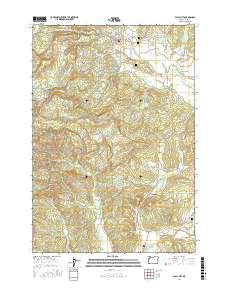
2017 Map of Falls City
USGS Topo · Published 2017About this map
Falls City sits as the central hub of this Polk County landscape, positioned where the Little Luckiamute River descends toward the broader valley. The terrain is defined by a transition from the elevated western peaks like Mt Sykes and the ridges along Bald Mountain Rd to the lower agricultural lands of McTimmonds Valley. To the west, the former lumber center of Black Rock is reached via Valsetz Rd, reflecting the region's historic dependence on timber and narrow-gauge transport routes.
Find a feature on this map
63 named features on this map. Tap any name to fly to it.
Don’t see what you’re looking for? This feature index may not catch every label — zoom into the map to look around manually.
Map Details
Editions of this 2017 Falls City Map
This is the sole edition of this map. No revisions or reprints were ever made.
Other maps of this area

1914 · Soap Creek
USGS Topo · 1:31,680

1921 · Corvallis
USGS Topo · 1:62,500

1922 · Airlie
USGS Topo · 1:31,680

1939 · Marys Peak
USGS Topo · 1:62,500

1942 · Marys Peak
USGS Topo · 1:62,500

1942 · Corvallis
USGS Topo · 1:62,500

1942 · Valsetz
USGS Topo · 1:62,500

1942 · Dallas
USGS Topo · 1:62,500

1953 · Salem
USGS Topo · 1:250,000

1954 · Salem
USGS Topo · 1:250,000