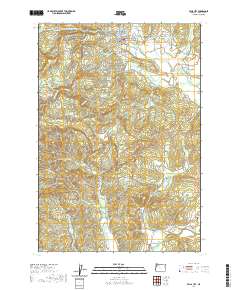
2020 Map of Falls City
USGS Topo · Published 2020About this map
Falls City serves as the primary hub of this Polk County landscape, situated along the Little Luckiamute River where the valley floor begins to transition into more complex terrain. The map records a concentration of local heritage sites, including the Falls City Cem, Falls City Odd Fellows Cem, and the Hubbard Cem nearby. To the west, the settlement of Black Rock and the elevations of Mt Sykes mark the higher ground, while the southern reaches descend toward Pedee and the broader McTimmonds Valley.
Find a feature on this map
63 named features on this map. Tap any name to fly to it.
Don’t see what you’re looking for? This feature index may not catch every label — zoom into the map to look around manually.
Map Details
Editions of this 2020 Falls City Map
This is the sole edition of this map. No revisions or reprints were ever made.
Other maps of this area

1914 · Soap Creek
USGS Topo · 1:31,680

1921 · Corvallis
USGS Topo · 1:62,500

1922 · Airlie
USGS Topo · 1:31,680

1939 · Marys Peak
USGS Topo · 1:62,500

1942 · Marys Peak
USGS Topo · 1:62,500

1942 · Corvallis
USGS Topo · 1:62,500

1942 · Valsetz
USGS Topo · 1:62,500

1942 · Dallas
USGS Topo · 1:62,500

1953 · Salem
USGS Topo · 1:250,000

1954 · Salem
USGS Topo · 1:250,000