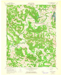
1963 Map of Falls of Rough
USGS Topo · Published 1965About this map
The Rough River winds through a complex terrain of deep hollows and high ridges at the intersection of Breckinridge, Grayson, and Ohio Counties. This early 1960s landscape is defined by the development of the Rough River Res, with the Rough River Dam and the adjacent Rough River Dam State Park appearing as significant modern landmarks. The mapping detail highlights the transition from traditional river-valley life to a recreational geography, though the older backbone of the community remains visible through numerous family cemeteries like Walker Cem and Payton Cem.
Find a feature on this map
60 named features on this map. Tap any name to fly to it.
Don’t see what you’re looking for? This feature index may not catch every label — zoom into the map to look around manually.
Map Details
Editions of this 1963 Falls of Rough Map
This is the sole edition of this map. No revisions or reprints were ever made.
Other maps of this area

1922 · Leitchfield
USGS Topo · 1:48,000

1925 · Spring Lick
USGS Topo · 1:62,500

1925 · Leitchfield
USGS Topo · 1:62,500

1932 · Fordsville
USGS Topo · 1:62,500

1953 · Mc Daniels
USGS Topo · 1:24,000

1953 · Kingswood
USGS Topo · 1:24,000

1953 · Falls Of Rough
USGS Topo · 1:24,000
1953 · Glen Dean
USGS Topo · 1:24,000
1953 · Fordsville
USGS Topo · 1:24,000

1954 · Evansville
USGS Topo · 1:250,000