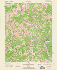
1953 Map of Fallsburg
USGS Topo · Published 1969About this map
The Big Sandy River forms a winding border between Kentucky and West Virginia in this mid-century survey, defining the industrial and social character of the region. The landscape is marked by a significant concentration of extractive industry, specifically numerous Oil fields that pepper the valleys and ridges between Fallsburg and Yatesville. These resources are supported by the strategic presence of the Norfolk and Western and Chesapeake and Ohio railroads, which track the riverbanks to move goods through the Appalachian foothills.
Find a feature on this map
119 named features on this map. Tap any name to fly to it.
Don’t see what you’re looking for? This feature index may not catch every label — zoom into the map to look around manually.
Map Details
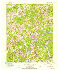
Editions of this 1953 Fallsburg Map
2 editions found
Other maps of this area

1901 · Ceredo
USGS Topo · 1:62,500

1903 · Kenova
USGS Topo · 1:125,000

1904 · Kenova
USGS Topo · 1:125,000

1911 · Louisa
USGS Topo · 1:48,000

1913 · Ceredo
USGS Topo · 1:62,500

1913 · Louisa
USGS Topo · 1:62,500

1939 · Louisa
USGS Topo · 1:62,500
1953 · Prichard
USGS Topo · 1:24,000

1953 · Rush
USGS Topo · 1:24,000

1953 · Boltsfork
USGS Topo · 1:24,000