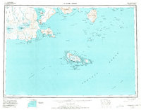
1949 Map of False Pass
USGS Topo · Published 1971About this map
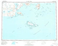
Unimak Island and the western tip of the Alaska Peninsula meet at the narrow gateway of Isanotski Strait, where the settlement of False Pass serves as a critical maritime link. This 1949 reconnaissance survey, updated with revisions through 1970, illustrates the dramatic volcanic topography of the Eastern Aleutians, dominated by the massive heights of Shishaldin Volcano and Isanotski Peaks. To the south, Sanak Island and its surrounding archipelago rise from the Pacific Ocean, anchored by the small settlement of Sanak and protected harbors like Pavlof Harbor. The map reveals a landscape defined by its coastal features, from the deep waters of Ikatan Bay to the treacherous stretches of the Sandman Reefs, providing a detailed view of these remote fishing and navigation grounds during the mid-20th century.
Find a feature on this map
145 named features on this map. Tap any name to fly to it.
Don’t see what you’re looking for? This feature index may not catch every label — zoom into the map to look around manually.
Map Details
Editions of this 1949 False Pass Map
6 editions found
Other maps of this area

1943 · Fort Randall
USGS Topo · 1:250,000
1944 · Cold Bay Sheet No. 20 of 25
USGS Topo · 1:25,000

1949 · False Pass
USGS Topo · 1:250,000

1949 · Fort Randall
USGS Topo · 1:250,000

1950 · False Pass
USGS Topo · 1:250,000

1950 · Fort Randall
USGS Topo · 1:250,000

1951 · Unimak
USGS Topo · 1:250,000

1953 · Port Moller
USGS Topo · 1:250,000

1958 · Unimak
USGS Topo · 1:250,000

1963 · Port Moller A-5
USGS Topo · 1:63,360