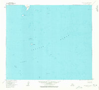
1963 Map of False Pass D-0
USGS Topo · Published 1972About this map
Outer Iliasilk Island and the scattered outcroppings of the Pacific Ocean dominate this maritime survey of the Aleutian waters. Grounded in data from mid-century aerial photography and hydrographic charts, the map reveals a treacherous coastal environment defined by submerged hazards and isolated landmasses. Navigational landmarks like Pinnacle Rock and the extensive Sandman Reefs are meticulously positioned, reflecting the critical importance of these features for seafaring safety in the late 1950s and early 1960s. Small, named islands such as Sushilnoi Island and Rose Island emerge from the depth contours, while named obstructions like Olga Rock and John Rock sit as solitary sentinels in the open sea. This documentation provides a precise record of the shoreline and depth soundings as they were recorded before later 20th-century revisions.
Find a feature on this map
13 named features on this map. Tap any name to fly to it.
Don’t see what you’re looking for? This feature index may not catch every label — zoom into the map to look around manually.
Map Details
Editions of this 1963 False Pass D-0 Map
2 editions found
Other maps of this area

1943 · Fort Randall
USGS Topo · 1:250,000

1949 · False Pass
USGS Topo · 1:250,000

1949 · Fort Randall
USGS Topo · 1:250,000

1950 · False Pass
USGS Topo · 1:250,000

1950 · Fort Randall
USGS Topo · 1:250,000

1953 · Port Moller
USGS Topo · 1:250,000

1963 · Port Moller A-5
USGS Topo · 1:63,360

1963 · Port Moller A-6
USGS Topo · 1:63,360
1963 · False Pass D-0
USGS Topo · 1:63,360

1963 · False Pass D-1
USGS Topo · 1:63,360