
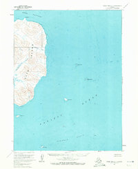
1963 Map of False Pass D-1
USGS Topo · Published 1967About this map
Deer Island dominates the western portion of this maritime survey, separated from the mainland by the waters of Deer Passage. The island's interior is defined by steep relief, drained by small waterways such as Eastern Creek and Southern Creek. Along the southwestern coast near Fawn Point, the inclusion of ruins suggests a legacy of prior habitation or activity in this isolated environment.
Find a feature on this map
21 named features on this map. Tap any name to fly to it.
Don’t see what you’re looking for? This feature index may not catch every label — zoom into the map to look around manually.
Map Details
Editions of this 1963 False Pass D-1 Map
2 editions found
Other maps of this area

1943 · Fort Randall
USGS Topo · 1:250,000

1949 · False Pass
USGS Topo · 1:250,000

1949 · Fort Randall
USGS Topo · 1:250,000

1950 · False Pass
USGS Topo · 1:250,000

1950 · Fort Randall
USGS Topo · 1:250,000

1953 · Port Moller
USGS Topo · 1:250,000

1963 · Port Moller A-6
USGS Topo · 1:63,360
1963 · False Pass D-0
USGS Topo · 1:63,360
1963 · False Pass C-2
USGS Topo · 1:63,360

1963 · False Pass D-2
USGS Topo · 1:63,360