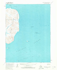
1963 Map of False Pass D-1
USGS Topo · Published 1972About this map
Deer Island dominates this maritime survey of the Aleutian landscape, revealing a coastline defined by steep elevations and drainage systems like Eastern Creek and Southern Creek. The topography, annotated in the early 1960s, highlights the isolation of this archipelago environment where Deer Passage separates the main landmass from the broader Pacific Ocean. Near the southern tip of the island at Fawn Point, the map indicates Ruins, providing a rare terrestrial point of interest for historians and archaeologists studying early human activity or seasonal encampments in the region.
Find a feature on this map
14 named features on this map. Tap any name to fly to it.
Don’t see what you’re looking for? This feature index may not catch every label — zoom into the map to look around manually.
Map Details
Editions of this 1963 False Pass D-1 Map
2 editions found
Other maps of this area

1943 · Fort Randall
USGS Topo · 1:250,000

1949 · False Pass
USGS Topo · 1:250,000

1949 · Fort Randall
USGS Topo · 1:250,000

1950 · False Pass
USGS Topo · 1:250,000

1950 · Fort Randall
USGS Topo · 1:250,000

1953 · Port Moller
USGS Topo · 1:250,000

1963 · Port Moller A-6
USGS Topo · 1:63,360
1963 · False Pass D-0
USGS Topo · 1:63,360
1963 · False Pass C-2
USGS Topo · 1:63,360

1963 · False Pass D-1
USGS Topo · 1:63,360