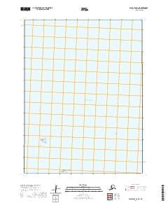
2020 Map of False Pass D-1 NE
USGS Topo · Published 2020About this map
Patton Island and the Buyan Islands stand as small outposts within the vast waters of the Pacific Ocean in this 2020 topographic survey of the Aleutian chain. This specific quadrant is defined almost entirely by its maritime character, documenting the precise location of these minor landforms relative to the maritime township and range grid, including t61s r86w and t61s r85w.
Find a feature on this map
7 named features on this map. Tap any name to fly to it.
Don’t see what you’re looking for? This feature index may not catch every label — zoom into the map to look around manually.
Map Details
Editions of this 2020 False Pass D-1 NE Map
This is the sole edition of this map. No revisions or reprints were ever made.
Other maps of this area

1943 · Fort Randall
USGS Topo · 1:250,000

1949 · False Pass
USGS Topo · 1:250,000

1949 · Fort Randall
USGS Topo · 1:250,000

1950 · False Pass
USGS Topo · 1:250,000

1950 · Fort Randall
USGS Topo · 1:250,000

1953 · Port Moller
USGS Topo · 1:250,000

1963 · Port Moller A-6
USGS Topo · 1:63,360
1963 · False Pass D-0
USGS Topo · 1:63,360

1963 · False Pass D-1
USGS Topo · 1:63,360
1983 · Cold Bay A-1
USGS Topo · 1:63,360