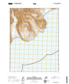
2020 Map of False Pass D-3 NE
USGS Topo · Published 2020About this map
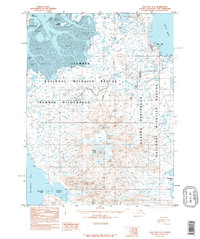
The Alaska Peninsula meets the sweeping waters of the Pacific Ocean in this high-resolution topographical study. The landscape is dominated by the elevations of the Aleutian Range, where steep contours descend toward the coastline. Coastal researchers and maritime historians can trace the intricate shoreline of the peninsula, which is punctuated by the sheltered waters of Thinpoint Cove in the northeast and the wide opening of Sandy Cove to the southwest. This area, largely devoid of modern infrastructure or permanent settlements, represents a remote stretch of the Aleutian wilderness as it was documented in 2020. The map provides a precise view of the physical geography and township boundaries including t60s r89w, t60s r88w, and t61s r90w, serving as a foundational record of the region's natural state and maritime boundaries.
Find a feature on this map
8 named features on this map. Tap any name to fly to it.
Don’t see what you’re looking for? This feature index may not catch every label — zoom into the map to look around manually.
Map Details
Editions of this 2020 False Pass D-3 NE Map
This is the sole edition of this map. No revisions or reprints were ever made.
Other maps of this area

1943 · Fort Randall
USGS Topo · 1:250,000
1944 · Cold Bay Sheet No. 20 of 25
USGS Topo · 1:25,000

1949 · False Pass
USGS Topo · 1:250,000

1949 · Fort Randall
USGS Topo · 1:250,000

1950 · False Pass
USGS Topo · 1:250,000

1950 · Fort Randall
USGS Topo · 1:250,000
1963 · False Pass D-3
USGS Topo · 1:63,360

1963 · False Pass D-2
USGS Topo · 1:63,360
1995 · Cold Bay A-2
USGS Topo · 1:63,360
1995 · Cold Bay A-3
USGS Topo · 1:63,360