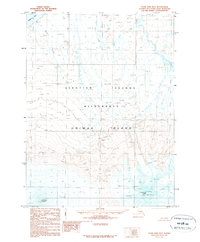
1989 Map of False Pass D-6
USGS Topo · Published 1989About this map
Shishaldin Volcano anchors the southwestern landscape of this survey, marking a dramatic topographic high point on Unimak Island. The terrain is characterized by the extreme elevations of the eastern Aleutian range, including the jagged profiles of Isanotski Peaks and the descriptive Ragged Jack. Much of this territory is preserved within the Aleutian Islands Wilderness, where the land drops away from glacial peaks toward the shoreline of Bristol Bay. Waterways like North Creek and Coal Creek drain the northern slopes, illustrating the drainage patterns from the volcanic highlands to the sea. This 1989 provisional edition captures the raw geography of the island before modern shifts in glacial coverage, providing a base for studying the volcanic morphology of the Alaska Peninsula region.
Find a feature on this map
9 named features on this map. Tap any name to fly to it.
Don’t see what you’re looking for? This feature index may not catch every label — zoom into the map to look around manually.
Map Details
Editions of this 1989 False Pass D-6 Map
This is the sole edition of this map. No revisions or reprints were ever made.
Other maps of this area

1943 · Fort Randall
USGS Topo · 1:250,000

1949 · False Pass
USGS Topo · 1:250,000

1949 · Fort Randall
USGS Topo · 1:250,000

1950 · False Pass
USGS Topo · 1:250,000

1950 · Fort Randall
USGS Topo · 1:250,000

1951 · Unimak
USGS Topo · 1:250,000

1958 · Unimak
USGS Topo · 1:250,000

1989 · Unimak C-1
USGS Topo · 1:63,360
1989 · False Pass C-6
USGS Topo · 1:63,360
1989 · Unimak D-1
USGS Topo · 1:63,360