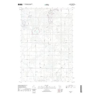
2018 Map of Falun
USGS Topo · Published 2018About this map
Alpha and Falun serve as the primary hubs in this corner of Burnett County, where the landscape is defined by an intricate network of wetlands and managed water systems. The northern reaches of the quadrangle are dominated by complex water controls, including the Refuge Bypass and Phantom Lake Bypass, which feed into major impoundments like the Upper Phantom Flowage and North Fork Flowage. This 2018 survey reveals a rural infrastructure deeply tied to conservation and water management, with numerous dikes such as Main Dike Rd and N Fork Dike Rd traversing the marshy terrain. For family historians, the map identifies several local burial grounds, including Anscarius Cem, Wood Lake Cem, and Freya Cem, often located near established farm-to-market roads like Co Hwy D and Range Line Rd.
Find a feature on this map
57 named features on this map. Tap any name to fly to it.
Don’t see what you’re looking for? This feature index may not catch every label — zoom into the map to look around manually.
Map Details
Editions of this 2018 Falun Map
This is the sole edition of this map. No revisions or reprints were ever made.
Other maps of this area

1950 · Webster
USGS Topo · 1:48,000

1950 · Grantsburg
USGS Topo · 1:48,000

1951 · Milltown
USGS Topo · 1:48,000

1951 · Frederic
USGS Topo · 1:48,000

1953 · Stillwater
USGS Topo · 1:250,000

1955 · Webster
USGS Topo · 1:62,500

1955 · Frederic
USGS Topo · 1:62,500

1955 · Milltown
USGS Topo · 1:62,500

1955 · Stillwater
USGS Topo · 1:250,000

1958 · Stillwater
USGS Topo · 1:250,000