
1962 Map of Fannin
USGS Topo · Published 1963About this map
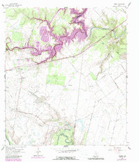
The San Antonio River and Coleto Creek define the lowlands of this Goliad County landscape, where ranching and resource extraction intersect with Texas history. Near the town of Fannin, the Fannin State Park preserves the site of a pivotal revolutionary conflict, marked here by the Battlefield Mon. The surrounding terrain is heavily influenced by the petroleum industry, evidenced by the expansive Fannin East Oil Field, Battle Oil Field, and numerous gas wells scattered across the prairie.
Find a feature on this map
37 named features on this map. Tap any name to fly to it.
Don’t see what you’re looking for? This feature index may not catch every label — zoom into the map to look around manually.
Map Details
Editions of this 1962 Fannin Map
2 editions found
Other maps of this area

1953 · Beeville
USGS Topo · 1:250,000

1956 · Beeville
USGS Topo · 1:250,000

1960 · Beeville
USGS Topo · 1:250,000

1962 · Live Oak Lake
USGS Topo · 1:24,000

1962 · Lott Lake
USGS Topo · 1:24,000

1962 · McFaddin
USGS Topo · 1:24,000

1962 · Hensley Lake
USGS Topo · 1:24,000

1962 · Raisin
USGS Topo · 1:24,000
1963 · Ander
USGS Topo · 1:24,000
1964 · Schroeder
USGS Topo · 1:24,000