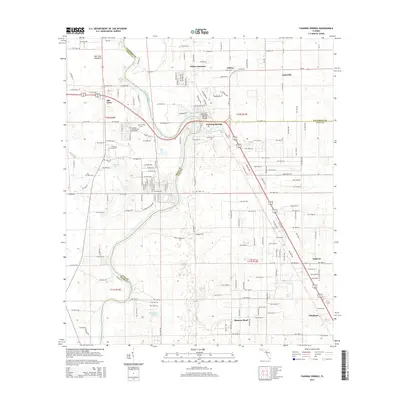
2015 Map of Fanning Springs
USGS Topo · Published 2015About this map
The Suwannee River meanders across this landscape, forming the natural boundary between Dixie, Gilchrist, and Levy Counties. This 2015 record documents the corridor around the Fanning Springs Bridge, where the riverside community of Fanning Springs serves as a hub for the surrounding region. The map captures the distinct settlement patterns of North Central Florida, from the more established town of Chiefland in the southeast to the smaller hamlets and junctions that punctuate the pine and swamp terrain. Local history is anchored at the Old Town Cem and Shady Grove Cem, while the geography is defined by scattered water bodies like Jennings Lake, Long Pond, and Shacklefoot Pond. Smaller locales such as Wilcox Junction, Lottieville, and Old Town illustrate the rural network of homes and roads that branch out from the river’s edge.
Find a feature on this map
117 named features on this map. Tap any name to fly to it.
Don’t see what you’re looking for? This feature index may not catch every label — zoom into the map to look around manually.
Map Details
Editions of this 2015 Fanning Springs Map
This is the sole edition of this map. No revisions or reprints were ever made.
Other maps of this area

1954 · Eugene
USGS Topo · 1:24,000

1954 · Cross City East
USGS Topo · 1:24,000

1954 · Chiefland
USGS Topo · 1:24,000

1954 · Manatee Springs
USGS Topo · 1:24,000

1954 · Vista
USGS Topo · 1:24,000

1954 · Gainesville
USGS Topo · 1:250,000

1958 · Gainesville
USGS Topo · 1:250,000

1959 · Gainesville
USGS Topo · 1:250,000

1968 · Fourmile Lake
USGS Topo · 1:24,000

1968 · Trenton
USGS Topo · 1:24,000