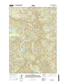
2017 Map of Fanno Ridge
USGS Topo · Published 2017About this map
Black Rock sits as a lonely outlier of settlement in the northeastern corner of this 2017 survey, serving as a gateway to the dense, high-elevation terrain of the Oregon Coast Range. The topography is defined by the headwaters of several major drainages, most notably the Little Luckiamute River and the S Fork Siletz River, which carve deep paths through the timberlands. Key ridges such as Fanno Ridge and Cougar Ridge provide the structural framework for the landscape, while peaks like Bald Mtn and Green Mtn rise above the surrounding slopes. The network of forest roads, including Valsetz Rd and Black Rock Rd, follows the difficult contours of the land, hinting at the area's legacy of commercial timber harvest and the rugged transit required to navigate these drainages.
Find a feature on this map
41 named features on this map. Tap any name to fly to it.
Don’t see what you’re looking for? This feature index may not catch every label — zoom into the map to look around manually.
Map Details
Editions of this 2017 Fanno Ridge Map
This is the sole edition of this map. No revisions or reprints were ever made.
Other maps of this area

1921 · Corvallis
USGS Topo · 1:62,500

1939 · Marys Peak
USGS Topo · 1:62,500

1942 · Marys Peak
USGS Topo · 1:62,500

1942 · Corvallis
USGS Topo · 1:62,500

1942 · Valsetz
USGS Topo · 1:62,500

1942 · Dallas
USGS Topo · 1:62,500

1953 · Salem
USGS Topo · 1:250,000

1954 · Salem
USGS Topo · 1:250,000
1956 · Corvallis
USGS Topo · 1:62,500

1956 · Valsetz
USGS Topo · 1:62,500