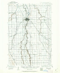
1895 Map of Fargo
USGS Topo · Published 1962About this map
The Red River serves as the central artery of this late nineteenth-century landscape, defining the winding boundary between North Dakota and Minnesota. The neighboring hubs of Fargo and Moorhead dominate the center of the sheet, where an intricate network of iron rails converges. The presence of the Northern Pacific Railroad and the Great Northern Railway highlights the region's importance as a transportation corridor during its early agricultural expansion. Outside these primary settlements, the map documents a series of smaller siding towns and rural outposts such as Kurtz (Elmer Sta.), Hickson, and Christine. To the east, the Buffalo River meanders across Spring Prairie, while the Sheyenne River and Wild Rice River carve through the western plains, illustrating the water-dependent settlement patterns of Cass and Clay counties.
Find a feature on this map
73 named features on this map. Tap any name to fly to it.
Don’t see what you’re looking for? This feature index may not catch every label — zoom into the map to look around manually.
Map Details
Editions of this 1895 Fargo Map
3 editions found
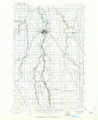
Other maps of this area

1895 · Fargo
USGS Topo · 1:125,000

1895 · Casselton
USGS Topo · 1:125,000

1897 · Fargo
USGS Topo · 1:125,000

1897 · Casselton
USGS Topo · 1:125,000

1904 · Wahpeton
USGS Topo · 1:125,000

1907 · Wyndmere
USGS Topo · 1:125,000

1918 · Ulen
USGS Topo · 1:62,500

1919 · Rothsay
USGS Topo · 1:62,500

1919 · Barnesville
USGS Topo · 1:62,500

1919 · Hawley
USGS Topo · 1:62,500