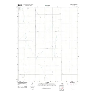
2010 Map of Fargo SE
USGS Topo · Published 2010About this map
Boggy Creek and Turkey Creek carve southward through this section of Ellis County, defining the drainage patterns of a landscape marked by the precise grid of Oklahoma’s sectional survey system. The map captures the rural character of the area southeast of Fargo in the early 21st century, where the transition from town to open country is marked by the presence of Fargo Cemetery at the northwestern edge. Further east, the Gnadenfield Cemetery sits along E0450 Rd, serving as a quiet focal point for local genealogical interest. The transportation network is dominated by a systematic numbering of section-line roads, such as N1920 Rd and E0480 Rd, while the Sharon-Shattuck Rd provides a primary east-west corridor through the southern reaches of the quadrangle.
Find a feature on this map
21 named features on this map. Tap any name to fly to it.
Don’t see what you’re looking for? This feature index may not catch every label — zoom into the map to look around manually.
Map Details
Editions of this 2010 Fargo SE Map
This is the sole edition of this map. No revisions or reprints were ever made.
Other maps of this area

1955 · Woodward
USGS Topo · 1:250,000

1958 · Woodward
USGS Topo · 1:250,000

1969 · Fargo SW
USGS Topo · 1:24,000

1969 · Fargo
USGS Topo · 1:24,000

1969 · Fargo NW
USGS Topo · 1:24,000

1969 · Vici NW
USGS Topo · 1:24,000

1969 · Woodward SW
USGS Topo · 1:24,000

1969 · Woodward
USGS Topo · 1:24,000

1969 · Fargo SE
USGS Topo · 1:24,000

1970 · Harmon
USGS Topo · 1:24,000