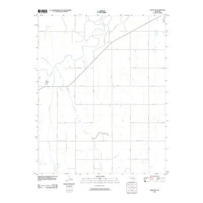
2010 Map of Fargo SW
USGS Topo · Published 2010About this map
Wolf Creek and its various tributaries, including Little Wolf Creek and Twentyfive Mile Creek, define the drainage patterns of this Ellis County landscape. The map showcases a transition from the riparian corridors along these waterways to the strictly gridded section lines of the surrounding plains. A notable local landmark, The Artesian Beach, is situated along the western edge of the quadrangle, hinting at the regional hydrology and potential for local recreation in this otherwise agricultural setting. The area is intersected by a systematic road network, including the diagonal Sharon-Shattuck Rd and various numbered routes like E0480 Rd and N1870 Rd. The northern portion of the map is also marked by Lease Rd and Buzzard Creek, illustrating the intersection of natural drainage and rural development in the early 21st century.
Find a feature on this map
21 named features on this map. Tap any name to fly to it.
Don’t see what you’re looking for? This feature index may not catch every label — zoom into the map to look around manually.
Map Details
Editions of this 2010 Fargo SW Map
This is the sole edition of this map. No revisions or reprints were ever made.
Other maps of this area

1955 · Woodward
USGS Topo · 1:250,000

1958 · Woodward
USGS Topo · 1:250,000

1969 · Fargo SW
USGS Topo · 1:24,000

1969 · Fargo
USGS Topo · 1:24,000

1969 · Fargo NW
USGS Topo · 1:24,000

1969 · Gage
USGS Topo · 1:24,000

1969 · Fargo SE
USGS Topo · 1:24,000

1969 · Shattuck NE
USGS Topo · 1:24,000

1970 · Arnett
USGS Topo · 1:24,000

1970 · Harmon
USGS Topo · 1:24,000