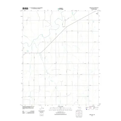
2012 Map of Fargo SW
USGS Topo · Published 2012About this map
Wolf Cr and its tributaries carve a winding path through this portion of Ellis County, defining the drainage patterns of the High Plains landscape. The northeastern corner of the map captures the edge of Fargo, where local transit is anchored by a diagonal highway and a structured grid of rural roads such as E0450 Rd and N1890 Rd. The terrain is marked by several seasonal watercourses including Little Wolf Cr, Buzzard Cr, and the uniquely named Twentyfive Mile Cr. This 2012 survey illustrates a modern rural layout where agricultural access is facilitated by a dense network of sectional roads, including several specifically designated as Lease Rd, indicating the intersection of ranching and land use common to western Oklahoma.
Find a feature on this map
23 named features on this map. Tap any name to fly to it.
Don’t see what you’re looking for? This feature index may not catch every label — zoom into the map to look around manually.
Map Details
Editions of this 2012 Fargo SW Map
This is the sole edition of this map. No revisions or reprints were ever made.
Other maps of this area

1955 · Woodward
USGS Topo · 1:250,000

1958 · Woodward
USGS Topo · 1:250,000

1969 · Fargo SW
USGS Topo · 1:24,000

1969 · Fargo
USGS Topo · 1:24,000

1969 · Fargo NW
USGS Topo · 1:24,000

1969 · Gage
USGS Topo · 1:24,000

1969 · Fargo SE
USGS Topo · 1:24,000

1969 · Shattuck NE
USGS Topo · 1:24,000

1970 · Arnett
USGS Topo · 1:24,000

1970 · Harmon
USGS Topo · 1:24,000