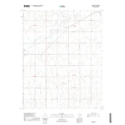
2018 Map of Fargo SW
USGS Topo · Published 2018About this map
Wolf Cr and its tributaries carve a complex drainage system across this portion of Ellis County, defining the local topography between the settlements of Gage and Fargo. The landscape is dominated by a grid of rural section roads, including Sharon-Shattuck Rd and Svc Rd No 16, which provide access to the various rangelands and farmsteads. Smaller waterways like Buzzard Cr, Little Wolf Cr, and the uniquely named Twentytwo Mile Cr weave through the township divisions of T22N and T21N. While the map primarily details open country, the edges of Fargo at the northeast and Gage at the west provide urban context with named streets such as Oak St and Pecan St. This 2018 survey illustrates the persistent rural character of western Oklahoma, where the land remains divided by the Public Land Survey System and shaped by the perennial flow of its prairie creeks.
Find a feature on this map
30 named features on this map. Tap any name to fly to it.
Don’t see what you’re looking for? This feature index may not catch every label — zoom into the map to look around manually.
Map Details
Editions of this 2018 Fargo SW Map
This is the sole edition of this map. No revisions or reprints were ever made.
Other maps of this area

1955 · Woodward
USGS Topo · 1:250,000

1958 · Woodward
USGS Topo · 1:250,000

1969 · Fargo SW
USGS Topo · 1:24,000

1969 · Fargo
USGS Topo · 1:24,000

1969 · Fargo NW
USGS Topo · 1:24,000

1969 · Gage
USGS Topo · 1:24,000

1969 · Fargo SE
USGS Topo · 1:24,000

1969 · Shattuck NE
USGS Topo · 1:24,000

1970 · Arnett
USGS Topo · 1:24,000

1970 · Harmon
USGS Topo · 1:24,000