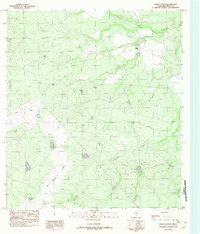
1982 Map of Farias Ranch
USGS Topo · Published 1982About this map
Farias Ranch stands as a primary landmark in this ranching region of Maverick County, which was surveyed in the mid-1970s and published as a provisional edition. The landscape is defined by the intermittent flow of desert waterways, including the winding Comanche Creek and the branching drainage of San Ambrosia Creek. These creek beds and their surrounding topography reveal the practical infrastructure of South Texas land management, exemplified by the precisely surveyed Spillway 711. The map documents a sparsely populated but active pastoral environment where water access and land elevation dictate the placement of ranch headquarters. The presence of Cuevas Creek further illustrates the complex drainage patterns that shape this corner of the state, providing a look at the rural Texas borderlands before later-century development changed local ranching traditions.
Find a feature on this map
5 named features on this map. Tap any name to fly to it.
Don’t see what you’re looking for? This feature index may not catch every label — zoom into the map to look around manually.
Map Details
Editions of this 1982 Farias Ranch Map
This is the sole edition of this map. No revisions or reprints were ever made.
Other maps of this area

1940 · Cometa
USGS Topo · 1:62,500

1940 · Eagle Pass
USGS Topo · 1:62,500

1941 · Botella Creek
USGS Topo · 1:62,500

1957 · Indio Creek
USGS Topo · 1:62,500

1957 · Botella Creek
USGS Topo · 1:62,500

1958 · Eagle Pass
USGS Topo · 1:250,000

1965 · Eagle Pass
USGS Topo · 1:250,000
1974 · Cometa
USGS Topo · 1:24,000
1974 · Sacatosa Tank
USGS Topo · 1:24,000
1982 · Indio Tank
USGS Topo · 1:24,000