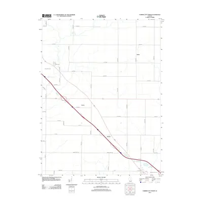
2012 Map of Farmer City North
USGS Topo · Published 2012About this map
Agricultural lands of eastern McLean County are meticulously charted in this 2012 survey, revealing the geometric precision of the Illinois prairie. Small clusters of development at Sabina, Empire, and Watkins dot the landscape, largely defined by an extensive grid of section-line roads like N 2800 E Rd and E 600 N Rd. These roads facilitate the transport of grain across a region where industrial-scale farming has long replaced the original wild prairie.
Find a feature on this map
46 named features on this map. Tap any name to fly to it.
Don’t see what you’re looking for? This feature index may not catch every label — zoom into the map to look around manually.
Map Details
Editions of this 2012 Farmer City North Map
This is the sole edition of this map. No revisions or reprints were ever made.
Other maps of this area

1937 · Monticello
USGS Topo · 1:48,000

1943 · Monticello
USGS Topo · 1:62,500

1951 · Le Roy
USGS Topo · 1:62,500

1952 · Arrowsmith
USGS Topo · 1:62,500

1957 · Maroa
USGS Topo · 1:62,500

1958 · Peoria
USGS Topo · 1:250,000

1961 · Peoria
USGS Topo · 1:250,000

1963 · Peoria
USGS Topo · 1:250,000

1979 · De Witt
USGS Topo · 1:24,000
1979 · Farmer City South
USGS Topo · 1:24,000