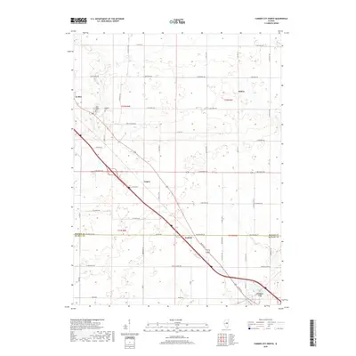
2018 Map of Farmer City North
USGS Topo · Published 2018About this map
The town of Farmer City anchors the southeast corner of this Illinois landscape, where the agricultural plains are bisected by the diagonal corridor of the interstate and rail lines. Northwest of the city, the small settlements of Empire and Watkins mark the transit route as it moves toward Le Roy. This area of the Corn Belt is defined by its rectilinear road grid, including Prairie Chapel Rd and Old Principal Rd, which trace the boundaries between townships and counties.
Find a feature on this map
50 named features on this map. Tap any name to fly to it.
Don’t see what you’re looking for? This feature index may not catch every label — zoom into the map to look around manually.
Map Details
Editions of this 2018 Farmer City North Map
This is the sole edition of this map. No revisions or reprints were ever made.
Other maps of this area

1937 · Monticello
USGS Topo · 1:48,000

1943 · Monticello
USGS Topo · 1:62,500

1951 · Le Roy
USGS Topo · 1:62,500

1952 · Arrowsmith
USGS Topo · 1:62,500

1957 · Maroa
USGS Topo · 1:62,500

1958 · Peoria
USGS Topo · 1:250,000

1961 · Peoria
USGS Topo · 1:250,000

1963 · Peoria
USGS Topo · 1:250,000

1979 · De Witt
USGS Topo · 1:24,000
1979 · Farmer City South
USGS Topo · 1:24,000