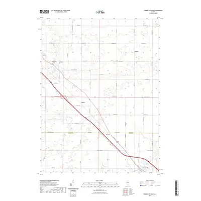
2021 Map of Farmer City North
USGS Topo · Published 2021About this map
The agricultural landscape of central Illinois is defined here by the crossing of major transit corridors and the subtle drainage of the N Fork Salt Cr. Stretching between the outskirts of Le Roy in the northwest and Farmer City in the southeast, this survey highlights a series of small rural nodes including Sabina, Empire, and Watkins. The boundary between McLean Co and De Witt Co cuts horizontally across the map, intersecting with the diagonal path of the regional rail and highway network.
Find a feature on this map
44 named features on this map. Tap any name to fly to it.
Don’t see what you’re looking for? This feature index may not catch every label — zoom into the map to look around manually.
Map Details
Editions of this 2021 Farmer City North Map
This is the sole edition of this map. No revisions or reprints were ever made.
Other maps of this area

1937 · Monticello
USGS Topo · 1:48,000

1943 · Monticello
USGS Topo · 1:62,500

1951 · Le Roy
USGS Topo · 1:62,500

1952 · Arrowsmith
USGS Topo · 1:62,500

1957 · Maroa
USGS Topo · 1:62,500

1958 · Peoria
USGS Topo · 1:250,000

1961 · Peoria
USGS Topo · 1:250,000

1963 · Peoria
USGS Topo · 1:250,000

1979 · De Witt
USGS Topo · 1:24,000
1979 · Farmer City South
USGS Topo · 1:24,000