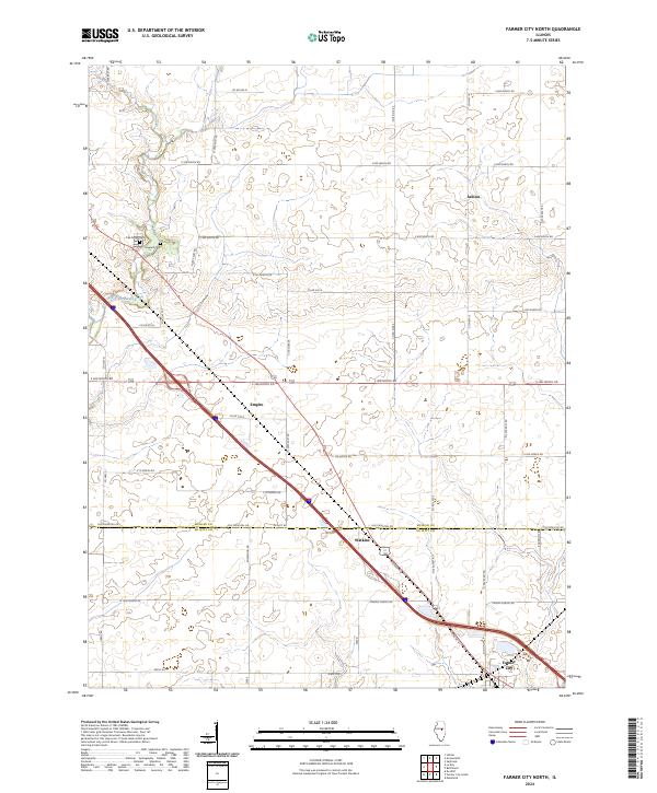
2024 Map of Farmer City North
USGS Topo · Published 2024About this map
The county boundary between McLean and De Witt counties cuts across this prairie landscape, where straight township roads define the agricultural grid. In the northwest, the North Fork Salt Creek meanders through the terrain, situated near the Oak Grove Cem and Howard Cem. Small clusters of development at Sabina, Empire, and Watkins mark the rural landscape, serving as historical waypoints between the larger hub of Farmer City to the south and the surrounding farmland. The presence of Old Principal Rd and various numbered county roads illustrates the evolution of local transportation from early settlement routes to the modern thoroughfares that connect these Illinois communities.
Find a feature on this map
46 named features on this map. Tap any name to fly to it.
Don’t see what you’re looking for? This feature index may not catch every label — zoom into the map to look around manually.
Map Details
Editions of this 2024 Farmer City North Map
This is the sole edition of this map. No revisions or reprints were ever made.
Other maps of this area

1937 · Monticello
USGS Topo · 1:48,000

1943 · Monticello
USGS Topo · 1:62,500

1951 · Le Roy
USGS Topo · 1:62,500

1952 · Arrowsmith
USGS Topo · 1:62,500

1957 · Maroa
USGS Topo · 1:62,500

1958 · Peoria
USGS Topo · 1:250,000

1961 · Peoria
USGS Topo · 1:250,000

1963 · Peoria
USGS Topo · 1:250,000

1979 · De Witt
USGS Topo · 1:24,000
1979 · Farmer City South
USGS Topo · 1:24,000