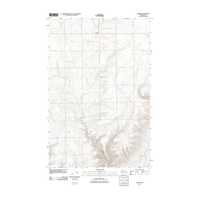
2011 Map of Farmer
USGS Topo · Published 2011About this map
Farmer occupies the northern reaches of this central Washington plateau, serving as a focal point for the surrounding agricultural grid. The landscape is defined by a strictly organized system of section-line roads, such as Road 1 SW and Farmer South Rd Sw, which segment the terrain into vast farming blocks. This 2011 survey by the U.S. Geological Survey illustrates the enduring rural character of Douglas County, where the topography transitions from flat upland fields into more complex drainage patterns toward the southeast.
Find a feature on this map
18 named features on this map. Tap any name to fly to it.
Don’t see what you’re looking for? This feature index may not catch every label — zoom into the map to look around manually.
Map Details
Editions of this 2011 Farmer Map
This is the sole edition of this map. No revisions or reprints were ever made.
Other maps of this area

1953 · Ritzville
USGS Topo · 1:250,000

1956 · Ephrata
USGS Topo · 1:62,500

1959 · Ritzville
USGS Topo · 1:250,000

1965 · Ritzville
USGS Topo · 1:250,000

1965 · Jameson Lake SW
USGS Topo · 1:24,000

1965 · Jameson Lake West
USGS Topo · 1:24,000
1966 · Palisades
USGS Topo · 1:24,000
1966 · Rattlesnake Springs
USGS Topo · 1:24,000

1968 · Withrow
USGS Topo · 1:24,000

1968 · Lamoine
USGS Topo · 1:24,000