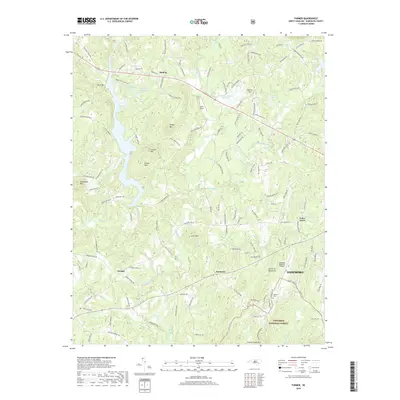
2019 Map of Farmer
USGS Topo · Published 2019About this map
The Uwharrie Mountains dominate this section of Randolph County, where the Uwharrie River winds past the settlements of Farmer and Mechanic. The southern portion of the map transitions into the Uwharrie National Forest, featuring peaks like Birkhead Mountain and Coolers Knob Mtn. This landscape reflects a mix of traditional rural life and aviation history, evidenced by small landing strips such as Delk's Airport and Spencer Field, alongside the larger Asheboro Regional Airport. Development is concentrated around the western edge of Asheboro and smaller communities like Motleta and Cedar Grove. For those tracing local heritage, the map identifies landmarks such as the Balfour Cem and numerous named water bodies including Back Creek and Caraway Creek, illustrating a topography shaped by both its ancient ridges and the legacy of early Piedmont cross-roads.
Find a feature on this map
132 named features on this map. Tap any name to fly to it.
Don’t see what you’re looking for? This feature index may not catch every label — zoom into the map to look around manually.
Map Details
Editions of this 2019 Farmer Map
This is the sole edition of this map. No revisions or reprints were ever made.
Other maps of this area

1951 · Fair Grove
USGS Topo · 1:24,000

1953 · Raleigh
USGS Topo · 1:250,000

1953 · Charlotte
USGS Topo · 1:250,000

1954 · Charlotte
USGS Topo · 1:250,000

1954 · Raleigh
USGS Topo · 1:250,000

1957 · Denton
USGS Topo · 1:62,500

1957 · Asheboro
USGS Topo · 1:62,500

1960 · Charlotte
USGS Topo · 1:250,000

1962 · Charlotte
USGS Topo · 1:250,000

1970 · Randleman
USGS Topo · 1:24,000