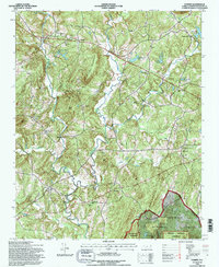
1994 Map of Farmer
USGS Topo · Published 1996About this map
The Uwharrie River winds through the southwestern reaches of this Randolph County landscape, creating a complex drainage network that includes Toms Creek and the meandering Caraway Creek. This mid-1990s survey by the Forest Service highlights a region defined by its prominent ridgelines, such as Hines Mountain and Parker Mtn, and the protected woodlands of the Birkhead Mtns Wilderness. The settlement pattern is largely rural and centered on small crossroads and civic hubs like Farmer, where the Farmer Elem Sch and Community Center serve the local population.
Find a feature on this map
52 named features on this map. Tap any name to fly to it.
Don’t see what you’re looking for? This feature index may not catch every label — zoom into the map to look around manually.
Map Details
Editions of this 1994 Farmer Map
This is the sole edition of this map. No revisions or reprints were ever made.
Other maps of this area

1951 · Fair Grove
USGS Topo · 1:24,000

1953 · Raleigh
USGS Topo · 1:250,000

1953 · Charlotte
USGS Topo · 1:250,000

1954 · Charlotte
USGS Topo · 1:250,000

1954 · Raleigh
USGS Topo · 1:250,000

1957 · Denton
USGS Topo · 1:62,500

1957 · Asheboro
USGS Topo · 1:62,500

1960 · Charlotte
USGS Topo · 1:250,000

1962 · Charlotte
USGS Topo · 1:250,000

1970 · Randleman
USGS Topo · 1:24,000